Contours are drawn as brown lines on the map and they connect points of equal height. They show the shape of the landscape; the hills, saddles and valleys.
The contour interval is the height difference vertically between the contour lines. Normally on orienteering maps the contour interval is 5 metres. Form lines (broken brown lines) are used to indicate extra contour detail which is under 5 metres high.
The contour lines are the only “imaginary” symbols on the map – all other symbols represent identifiable features on the ground.
Some Important Land Forms
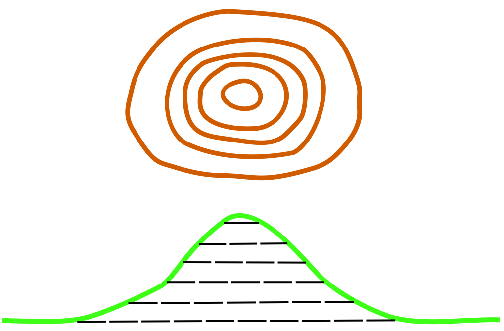
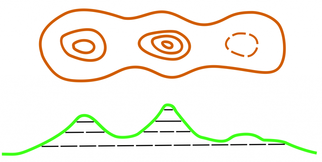
(a) Hills and Knolls
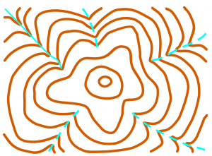
Hills and knolls (or small hills) are shown by a loop contour or several concentric loop contours depending on how it is. These two examples below show the contours and the corresponding profiles for some hills or different shapes and sizes.
A steep circular hill
Three knolls along a ridgeline
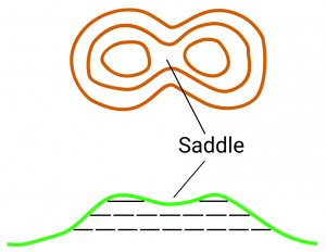
(b) Saddles
Named after a horse rider’s saddle, it is a low point between two knolls on a ridgeline.
A saddle between two knolls
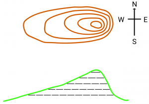
(c) Steep and Flat Terrain
Contour lines close together indicate steep slopes; contour lines a long way apart indicate gentle slopes.
On the eastern side of this hill the contours are close together, indicating a steep slope, but on the western side they are a long way apart, indicating a gently slope.
(d) Gullies and Spurs
A gully is a small valley, usually where water runs in wet weather. The gullies cut into the hillside. A spur is a sloping ridge jutting out from the side of a hill. In most Australian terrain, hillsides have been eroded to form a series of gullies separated by spurs. Every bend in a contour indicates either a gully or spur. It is crucial to be able to tell which of the two it is.
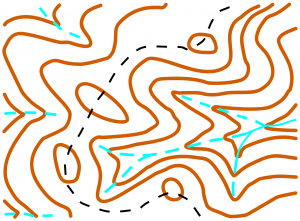
This map shows a large hill with 5 gullies running down the sides. In this example it is easy to identify the gullies because they each have a watercourse (blue line) mapped in them.
This map shows a more complex terrain, consisting of a ridgeline with 4 small knolls. A track runs along the top of the ridgeline. There is a series of gullies on both the western and eastern side of the ridgeline. On the eastern side of the ridge a network of 4 gullies flow into a larger valley.
(e) How to Know Which Way Is Uphill and Downhill?
It is not easy to tell, because unlike normal topographic maps, orienteering maps do not have the heights of the individual contours marked. One way is to locate a high point or a low point, and follow the contours from there.
Here are some other hints:
Look for closed loop contours indicating hill tops. These are the highest points in the landscape.
Gullies cut into the hill, Steep or narrow gullies tend to have a sharp ‘V’ shape.
Larger gullies and valleys will have a watercourse (blue line) mapped in them. Watercourses progressively join each other, forming a ‘blue’ network as they move to lower country. Large watercourses and rivers are located in the lowest part of the countryside.
(f) Importance of Contours
Experienced orienteers do much of their navigation by carefully reading the contours, and matching them with the shape of the landscape around them. This is particularly so in many parts of Australia where there is a distinct ‘gully-spur’ landform covered in open forest, with very little other detail.